
Flood risks are intensifying with climate change’s relentless advance. While technology has given us sophisticated flood maps to anticipate these natural disasters, in some places, these maps are fast becoming obsolete. Rising sea levels, increased storm intensities, and urban expansion are reshaping the flood risk landscape at a daunting pace. In these regions, relying on outdated maps is akin to using a compass in a world now navigated by GPS.
1. Miami, Florida
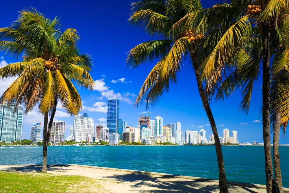
Picture this: the sun’s rays shimmering off Miami’s iconic skyline while the city’s underlying vulnerability to floods goes unnoticed by many. Rising sea levels are the silent saboteur, rendering existing flood maps inadequate at predicting the new threats facing this coastal paradise. Homes that were once considered safe are now at risk, as the old maps can no longer keep pace with the rapid changes. The Atlantic Ocean is gaining ground, and with it, the urgency for updated flood assessments grows.
A study by the Union of Concerned Scientists underscores this predicament, highlighting how Miami’s current flood risks are often underestimated. As tides rise higher and storms grow fiercer, the city’s resilience is continually tested. What was once a one-in-a-thousand-year flood risk is now alarmingly frequent. The imperative is clear: Miami needs to switch from reactive to proactive, reevaluating its flood prediction tools to safeguard its future.
2. New Orleans, Louisiana
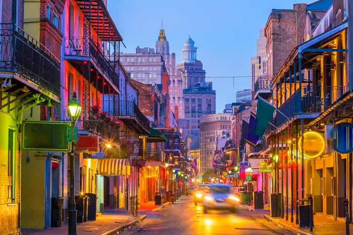
New Orleans, a city synonymous with resilience, has long danced with the threat of flooding. But in recent years, the rhythm has changed, and the stakes have never been higher. The city’s current flood maps, relics of a bygone era, fail to account for the rapid subsidence and extreme weather patterns now at play. With the Mississippi River and Lake Pontchartrain as neighbors, the city’s defenses are only as good as the data predicting their threats.
The city is caught in a balancing act, attempting to preserve its unique culture while fortifying against nature’s wrath. Levees and pumps work tirelessly, but without updated maps, the city’s efforts are akin to sailing a ship without a rudder. As New Orleans looks toward the future, embracing newer, more dynamic flood models is crucial. Only then can it hope to protect its vibrant community from the ever-looming water.
3. Houston, Texas

Houston, a sprawling metropolis known for its big heart, finds itself grappling with an outsized flood risk. The issue is not just the increasing frequency of rain events but also the city’s rapid expansion, which amplifies surface runoff. Current flood maps, struggling to keep up with Houston’s dynamic growth, are fast becoming outdated relics. The city faces a dual challenge: acknowledging its vulnerabilities while investing in innovative flood risk solutions.
A report from Rice University’s Severe Storm Prediction, Education, and Evacuation from Disasters (SSPEED) Center paints a clear picture of Houston’s precarious position. It emphasizes the need for comprehensive flood mapping that considers both urban sprawl and changing climate patterns. As Houston endeavors to stay ahead of these challenges, new strategies like green infrastructure and permeable pavements are coming into play. It’s a race against time, where the stakes are as vast as Texas itself.
4. Charleston, South Carolina

Charleston’s charm lies in its historic streets and elegant architecture, yet beneath this beauty lurks a growing flood threat. The city’s historic roots come with an ironic twist: an outdated flood prediction system that doesn’t reflect the realities of today. Rising sea levels and intensifying hurricanes are rewriting Charleston’s flood story, one that its old maps can’t narrate adequately. The need for modern, adaptable tools to predict and manage flood risks is increasingly evident.
In response, Charleston is embracing innovation and collaboration to protect its heritage and residents. By harnessing cutting-edge technology and local expertise, the city is striving to rewrite its flood narrative. Community engagement and smart planning are becoming the keystones of Charleston’s new flood strategy. While the road ahead is fraught with challenges, the city is determined to preserve its allure and ensure a secure future for its people.
5. Norfolk, Virginia
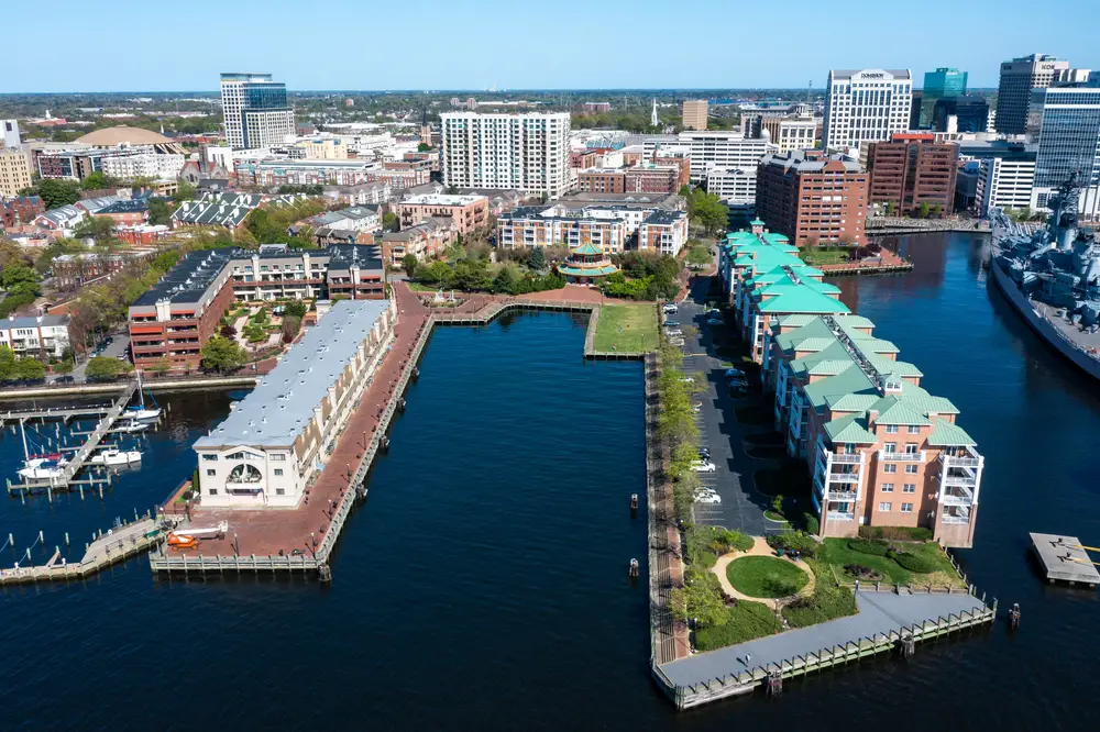
Norfolk, a city tightly woven into the fabric of military and maritime history, faces a rising tide of challenges. With its low-lying topography and proximity to the Chesapeake Bay, Norfolk is experiencing an accelerating frequency of floods. Current flood maps, designed in a different era, are no match for the city’s evolving flood landscape, where water levels threaten areas once deemed safe. The need for actionable flood data is growing as fast as the tides encroach upon its shores.
According to a report by the Virginia Institute of Marine Science, Norfolk’s flood risks are climbing at an alarming rate. The report calls for new, adaptive mapping techniques that can keep pace with environmental changes. Norfolk’s resilience lies in its ability to adapt, and with the right tools, it can turn the tide against this watery adversary. Embracing technology and innovative urban planning, the city is poised to protect its storied past while navigating an uncertain future.
6. Sacramento, California
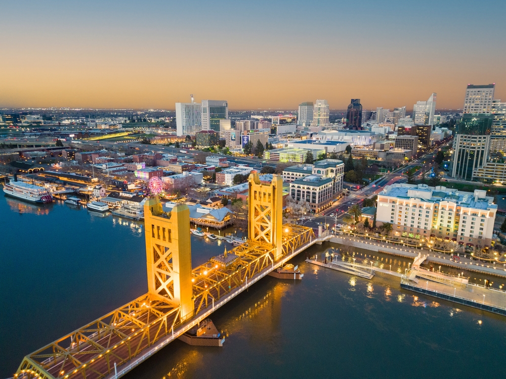
Sacramento, the capital of a state known for its diverse landscapes, faces a unique flood challenge. While often associated with droughts, California’s capital is not immune to flooding, with its rivers posing a significant threat. Outdated flood maps, based on historical data, fail to account for the increasing variability in weather patterns. This disconnect leaves the city vulnerable to unexpected inundations, its defenses undermined by incomplete information.
The city is taking steps to bridge this gap, recognizing the cost of inaction. Through updated flood infrastructure and community education, Sacramento is laying the groundwork for a more secure future. The journey forward is intricate, but the city is determined to protect its diverse communities. With a commitment to innovation, Sacramento is crafting a flood strategy as dynamic as its landscape.
7. Boston, Massachusetts

Boston, a city where history and progress intersect, finds itself at a crossroads with flooding challenges. The city’s flood maps are relics of a time when sea levels were predictable, leaving many areas exposed to the elements. Rising tides and extreme storm events are reshaping Boston’s shoreline, necessitating a reevaluation of flood risk strategies. The need for modernized mapping is crucial to preserving the city’s historical treasures and its thriving urban landscape.
Research from the Boston Planning & Development Agency highlights the urgency for new flood maps that reflect these evolving risks. The agency’s findings point to the potential for innovative urban planning to mitigate these threats. Boston’s commitment to resilience is evident in its investment in green infrastructure and climate adaptation. The city is poised to lead by example, embracing change while cherishing its rich heritage.
8. Galveston, Texas
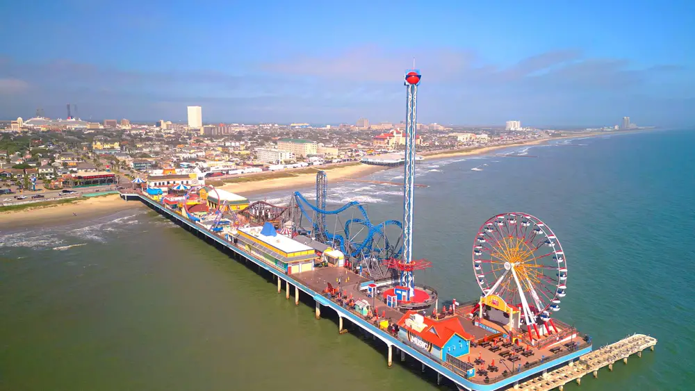
Galveston, with its sandy beaches and scenic vistas, is no stranger to the power of the sea. The island city has weathered many storms, but today, rising sea levels are rewriting its flood risk narrative. The existing maps, created in an era of less frequent extremes, no longer suffice to predict the threats Galveston faces. The sea is encroaching, and without updated flood data, the city’s defenses are compromised.
To combat this, Galveston is turning to science and community engagement as cornerstones of its new flood strategy. The city is investing in infrastructure and education aimed at mitigating flood risks. It’s a collaborative effort that seeks to balance Galveston’s charm with the realities of its environment. As the city navigates these challenges, it stands as a testament to resilience and adaptation.
9. New York, New York
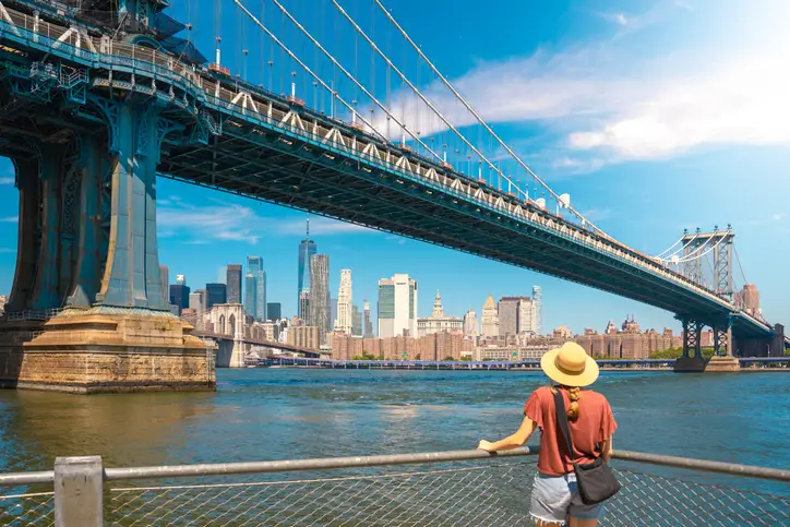
New York, the city that never sleeps, finds itself in a perpetual battle against the rising waters. From the shores of Staten Island to the bustling streets of Manhattan, the need for up-to-date flood maps has never been more evident. As storms grow more unpredictable and sea levels inch higher, the city’s outdated maps falter in guiding its resilience efforts. The Big Apple is at a critical juncture, where informed planning can mean the difference between vulnerability and security.
In response, New York is embracing a multifaceted approach to its flood challenges. The city is investing in innovative infrastructures, like seawalls and green spaces, to bolster its defenses. It’s a proactive stance that embodies the spirit of a city determined to thrive despite its challenges. As New York evolves, its commitment to safeguarding its diverse communities remains steadfast.
10. Jacksonville, Florida
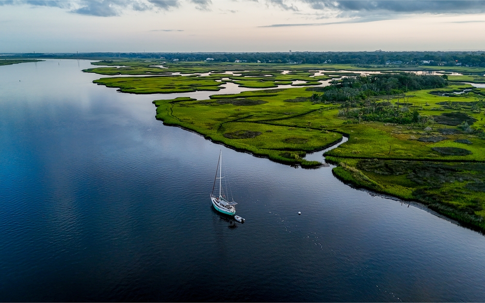
Jacksonville, a city known for its sprawling suburbs and riverside charm, faces a mounting flood risk that its current maps can’t capture. The St. Johns River, a defining feature of the city, poses an unpredictable threat as rainfall patterns shift. Existing maps are relics, unable to reflect the severity of increased storm activity and rising tides. With these gaps, the city’s ability to prepare for and respond to floods is significantly hindered.
The city’s leadership understands the importance of modernizing its flood response strategy. Through state-of-the-art technology and public engagement, Jacksonville is paving the way for resilience in the face of environmental change. The journey is challenging, but the commitment to protecting its people and preserving its natural beauty is unwavering. As Jacksonville looks to the future, it does so with a determination as deep as its iconic river.