Climate change is an ever-pressing issue that scientists and experts have been studying intensively for decades. While many aspects of climate change have become increasingly clear, there are still several weather phenomena that continue to baffle even the most seasoned climate change experts. These bizarre occurrences challenge our understanding and remind us of the complexities of our planet’s climate systems. Here are 13 such weather phenomena that remain mysterious and puzzling.
1. The Great Atlantic Mystery

In recent years, scientists have observed an unusual pattern of warming in the North Atlantic Ocean. This patch of unusually warm water, dubbed the “North Atlantic Warming Hole,” stands out against the backdrop of overall global warming. According to the National Oceanic and Atmospheric Administration (NOAA), this specific area remains cooler, and experts are scratching their heads trying to understand why. Some theories suggest this could be due to changes in ocean currents or the melting of Greenland’s ice sheets, but the full picture remains unclear.
This phenomenon is particularly perplexing because it contradicts the general trend of oceanic warming. Additionally, the Great Atlantic Mystery affects weather patterns across Europe and North America, potentially altering storm tracks and precipitation. Despite extensive research, scientists have yet to pinpoint the exact cause and implications of this anomaly. The uncertainty surrounding this phenomenon highlights the complexities of our climate systems and the need for continued investigation.
2. The Enigmatic South Pacific Blob

The South Pacific Blob is a massive area of unusually warm water that occasionally appears in the Pacific Ocean. It disrupts marine ecosystems, affecting everything from plankton to large fish species. This warm water mass, often blamed for widespread coral bleaching, defies simple explanations. Some research suggests it might be linked to natural climate variations, while others believe it could be an early indicator of broader climate change impacts.
What makes the South Pacific Blob particularly confusing is its seemingly random occurrence. There’s no predictable pattern to its appearance, making it difficult for scientists to study and understand. Its presence has significant ecological and economic consequences, particularly for fisheries in the region. As scientists continue to study this phenomenon, they hope to uncover its origins and potential long-term effects on the ocean’s health.
3. The Intriguing Arctic Lightning
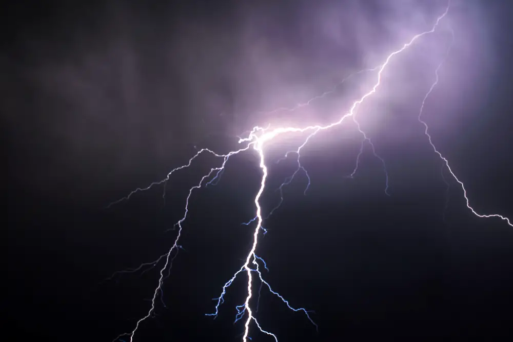
Lightning in the Arctic is an unusual phenomenon that has been increasingly reported in recent years. The Arctic, traditionally known for its icy and frigid conditions, rarely experiences the kind of convective storms that produce lightning. However, recent years have seen a surprising increase in lightning activity in the region. A study from the American Geophysical Union describes how this uptick in lightning is linked to rising temperatures and changing atmospheric conditions.
The implications of increased Arctic lightning are profound. It raises concerns about the potential for wildfires in the tundra and the release of stored carbon from permafrost. Moreover, it serves as a stark reminder of the rapid changes occurring in one of Earth’s most sensitive regions. Scientists are working hard to understand the causes and long-term impacts of this phenomenon, but many questions remain unanswered.
4. The Mysterious “Sky Rivers”
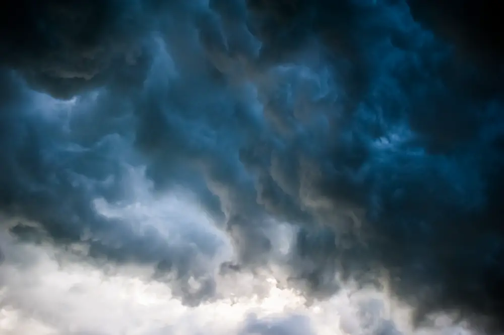
Imagine rivers flowing in the sky, transporting vast amounts of moisture across continents. These “sky rivers” or atmospheric rivers are known to deliver intense rainfall, particularly to coastal regions. While they play a crucial role in water cycles, their unpredictability and intensity can lead to devastating floods. Despite significant advancements in meteorology, the exact mechanisms governing the formation and path of these atmospheric rivers remain elusive.
One of the most famous atmospheric rivers is the “Pineapple Express,” which brings moisture from Hawaii to the West Coast of the United States. These sky rivers can hold more water than the largest terrestrial rivers, dumping significant amounts of precipitation in short periods. However, predicting their occurrence and potential impact is a major challenge for climatologists. The growing intensity of these rivers raises concerns about future flood risks, especially in vulnerable regions.
5. The Elusive Snow Donuts
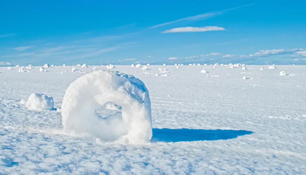
Snow donuts, or snow rollers, are one of nature’s most intriguing winter phenomena. These cylindrical snow formations occur when wind, temperature, and snow conditions align perfectly. They resemble doughnuts or rolls, typically found in open fields after a snowstorm. While they may seem like a simple curiosity, the specific conditions needed for their formation are surprisingly complex.
To create a snow donut, the snow must be sticky enough to roll without crumbling but light enough to be moved by the wind. This delicate balance makes snow donuts rare and difficult to predict. They often appear in clusters, adding to the mystery of their formation. For meteorologists, snow donuts are a reminder of the intricate interplay between weather elements and the surprises they can create.
6. The Curious Case of Ball Lightning
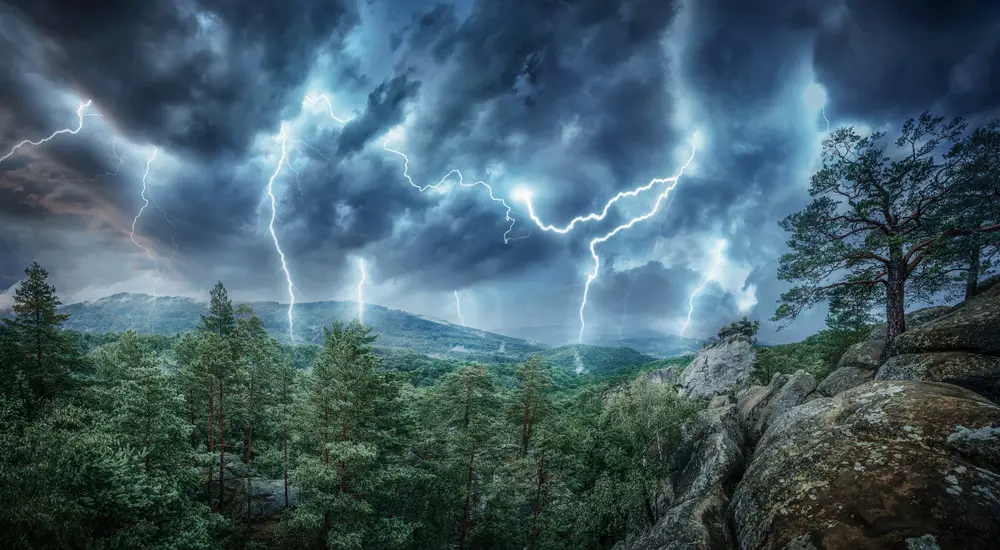
Ball lightning is a rare atmospheric phenomenon that has puzzled scientists for centuries. Witnesses describe glowing, spherical objects that appear during thunderstorms, sometimes lasting several seconds before disappearing. The mechanism behind ball lightning remains a mystery, though numerous theories have been proposed over the years. Some suggest it might be caused by the vaporization of silicon in soil during a lightning strike, while others believe it could involve plasma or microwave radiation.
Despite countless reports and some experimental successes, no single theory has gained unanimous acceptance among scientists. The unpredictable nature of ball lightning makes it difficult to study, with most data coming from eyewitness accounts. Efforts to recreate ball lightning in controlled environments have yielded intriguing but inconclusive results. Understanding this phenomenon could provide insights into the complexities of electrical storms and atmospheric physics.
7. The Strange Sea Foam Floods

In coastal regions around the world, sea foam occasionally accumulates in unusual quantities, creating surreal landscapes. These foam floods occur when organic and chemical compounds in the ocean mix with agitated seawater, forming thick layers of foam. While sea foam itself is not uncommon, the massive floods witnessed in some areas are baffling to scientists. Factors such as pollution, algal blooms, and oceanic conditions may contribute, but the exact causes remain unclear.
These foam events can have significant environmental and economic impacts. The foam can inundate coastal communities, disrupt transportation, and even pose health risks due to associated pollutants. Understanding the triggers and mechanics of sea foam floods is critical for mitigating their impacts. Although research is ongoing, the unpredictable nature of these events continues to challenge climate scientists and oceanographers.
8. The Enigma of Red Sprites
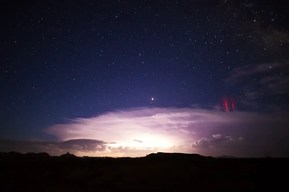
Red sprites are breathtakingly beautiful yet elusive electrical discharges that occur high above thunderstorms. These luminous reddish-orange flashes are difficult to spot from the ground, as they take place in the upper atmosphere. Discovered only recently, red sprites have intrigued scientists seeking to understand their formation and role in the atmospheric ecosystem. They are linked to lightning strikes, but their fleeting nature makes them hard to study.
Research suggests that red sprites may play a role in the electrical balance of the atmosphere. Observations from aircraft and satellites have provided some insights, but many questions remain unanswered. The conditions that lead to sprite formation, as well as their potential effects on atmospheric chemistry, are subjects of active investigation. As technology advances, scientists hope to capture more detailed data to unravel the mysteries of red sprites.
9. The Puzzling Green Flash
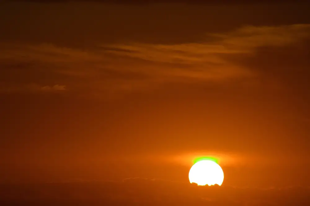
The green flash is a rare optical phenomenon that occurs at sunset or sunrise, where a green spot appears above the sun’s upper rim. It lasts only a few seconds, making it a sought-after sight for nature enthusiasts and photographers. This optical illusion results from the Earth’s atmosphere bending sunlight, but the precise conditions needed for a green flash are not fully understood. The phenomenon is more likely to be observed over the ocean, where the horizon is unobstructed.
While the basic science of refraction explains the green flash, its rarity and variability pose challenges to meteorologists. Atmospheric conditions such as air stability and temperature gradients play a role, but predicting when and where a green flash will occur is difficult. Historical accounts and modern observations have fueled curiosity and research into this optical event. Understanding the green flash could improve our knowledge of atmospheric optics and the interplay between light and air.
10. The Mystery of the Mammatus Clouds
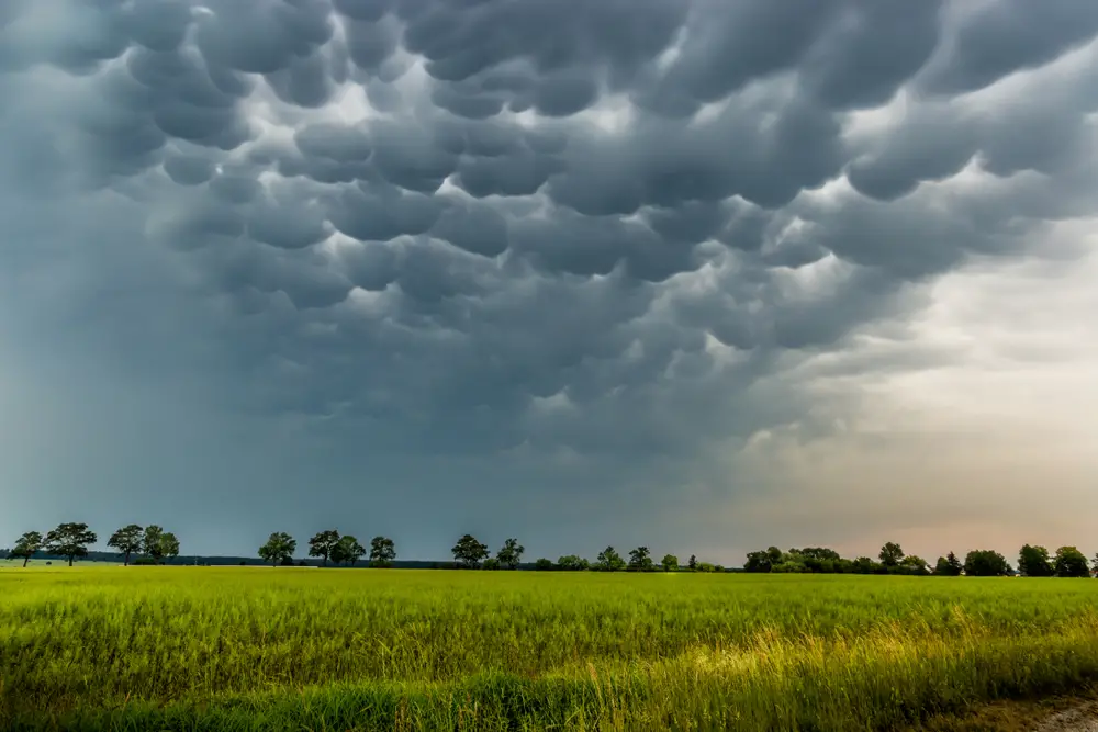
Mammatus clouds are distinctive, pouch-like formations that hang beneath the base of a cloud. Their unusual appearance often generates awe and speculation, particularly because they are associated with severe weather conditions. Despite their frequent occurrence, the processes that lead to their formation remain unclear. Some theories suggest that variations in moisture and temperature contribute to their development, but a definitive explanation is still lacking.
Mammatus clouds are typically seen in conjunction with cumulonimbus clouds, the towering formations that produce thunderstorms. They are a striking visual indicator of turbulent air, but their presence does not necessarily predict severe weather. Researchers continue to study mammatus clouds to better understand the dynamics of cloud formation and atmospheric instability. Their enigmatic nature adds to the beauty and complexity of the weather patterns we observe in the sky.
11. The Baffling “Heat Burst” Events

Heat bursts are sudden, localized increases in temperature that occur during the night or early morning. These rare events can cause temperatures to rise dramatically, sometimes by more than 20 degrees Fahrenheit in a matter of minutes. Caused by the rapid descent and compression of dry air from higher altitudes, heat bursts are difficult to predict and study. While they share similarities with downburst winds, the specifics of their occurrence remain poorly understood.
Meteorologists have identified heat bursts across various regions, often following thunderstorms. The rapid temperature spike can affect local agriculture, wildlife, and infrastructure, presenting unique challenges for those in affected areas. Despite technological advancements in weather observation, heat bursts continue to surprise scientists with their sudden and intense nature. Ongoing research aims to uncover the triggers and dynamics of these peculiar temperature anomalies.
12. The Enigmatic Ice Tsunamis

Ice tsunamis, also known as ice shoves, are rare events where strong winds push ice from a body of water onto the shore. These ice masses can move with surprising speed, causing damage to structures and landscapes in their path. The phenomenon is typically observed in areas with large freshwater lakes, particularly in the spring when the ice begins to melt. Despite their dramatic nature, the factors leading to ice tsunamis are not fully understood.
The dynamics of ice movement, wind conditions, and lake size all play roles in ice tsunami formation. While the basic mechanics are known, predicting when and where an ice shove will occur remains challenging. These events highlight the power of natural forces and the ongoing need to study cryospheric processes. As climate change continues to impact ice cover and weather patterns, understanding ice tsunamis becomes increasingly important for affected communities.
13. The Puzzling Morning Glory Clouds

Morning Glory clouds are long, tube-shaped formations that can stretch for hundreds of kilometers. Observed primarily in Northern Australia and a few other locations worldwide, these clouds are a rare meteorological phenomenon. They occur in specific atmospheric conditions, often associated with mesoscale systems and sea breezes. Despite their grandeur, the exact mechanisms behind Morning Glory cloud formation are not completely understood.
The rarity of Morning Glory clouds makes them a fascinating subject for meteorological research. Pilots and cloud enthusiasts travel great distances for the chance to witness and document this phenomenon. While scientific models provide some insights, the unpredictable nature of these clouds continues to challenge researchers. Further study of Morning Glory clouds could enhance our understanding of atmospheric physics and cloud dynamics, offering new insights into weather prediction and climate science.
